Last month, I wrote about the change over from the old Erie Canal to the new Barge Canal in the spring of 1918. I wanted to get into this a bit more this month.
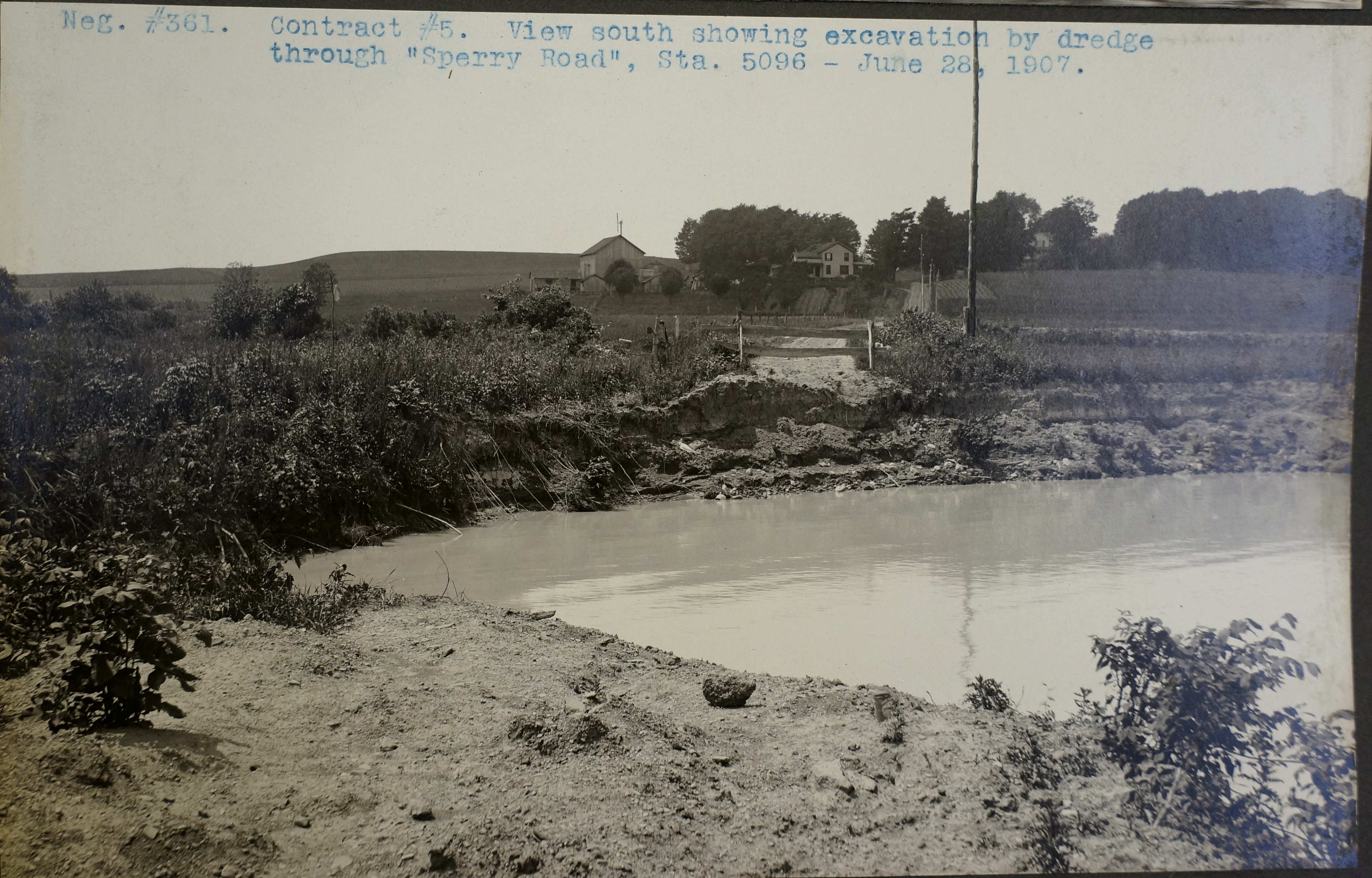
The impact of the new canal for the people of Cayuga County was minimal, if not negative. The new route of the canal using the Seneca River shifted the canal business out of the villages, and this had an impact on the economic life of the people who depended on the canal. But truthfully, by 1918, there was little traffic left on the old canal. Perhaps the largest impact was to the Tanner dry dock, whose business was canal boats. But the impact to the natural environment was extensive. The river was “canalized” by dredging a 12 foot deep channel and straightening some of the bends. At Mosquito Point, a new channel was cut south of the area known as Haiti (so named for its abolitionist roots), thus creating Hayti Island. (the image shows the new route of the river / canal cutting through Sperry Road). Campbells Island, which lay in the river south of Howland’s Island was removed. To regulate the river, a dam was added at the north end of Cayuga Lake at what is now Cayuga Seneca Lock 1. And a second dam was built on the Clyde River at May’s Point. To the east in Onondaga County, the State ditch at Jack’s Reef was deepened and enlarged, completing a project that had been ongoing since 1825. All this work served to lower the level of the river and lake by about four feet, causing the wetlands to dry up, and as a result, causing the waterfowl to leave. Later this would be addressed by the creation of the Montezuma Wildlife Refuge.
Early maps and plans for the Barge Canal called for a new route from Fox Ridge near Montezuma to Clyde. The canal would pass north of the ridge by May’s Point, following the route of Crosue Creek toward and through Savannah. This was done because the Cayuga Seneca Canal was not to be enlarged and either to be left at its small size or simply abandoned. But when the business interests at Ithaca, Seneca Falls, Geneva and Watkins Glen spoke up, the State changed it’s plans, and followed the route the the Seneca River to the Clyde River. A new river channel was cut directly between May’s Point and the north end of Cayuga Lake.
To service any possible business traffic that might wish to use the new canal, a small terminal was built at Weedsport. There the boats could tie up at the cement wall and receive freight from the area. It was little if ever used and soon became the home of the local buoy boat. Later, a oil tank farm would be built there. By this time, most traffic was shipped by the New York Central, West Shore and Lehigh Railroads.
During the construction of the Barge Canal, the State liked to compare the work that the State of New York was doing in building over 500 miles of modern canal to the work that the federal government was doing in building the 48 mile long Panama Canal. Of course the main attraction was that Teddy Roosevelt had started both projects, pushing the Barge Canal when he was Governor and then the Panama when he became President. Both projects began within a year of each other, around 1904, but the Panama was opened in 1914, and the Barge in 1918. Comparisons were made in the number of structures built, how much earth was dug, and how much concrete was poured. The biggest comparison was that it took all of the nation to build the Panama, while it only took New York to build it’s canal.
What is little recognized is what effect the Canadian system of locks and canals had upon the Barge Canal. Before the St. Lawrence Seaway was constructed in the 1950’s, Canada had built a series of short canals and locks to help pass ships around the rapids and fast water of the St. Lawrence River. The fight for transit to the Great Lakes had been gong on for decades with New York building the Erie in 1825, and then Canada building its system slightly larger then ours. New York then built the Enlarged Erie and then Canada enlarged its locks. When the Barge Canal was being built, the locks were only to be 28 feet wide, but some pointed out that the Canadian Locks were 45 feet wide. This is why when you visit the lock at Cayuga or Baldwinsville, you see a 45 foot wide lock instead of one that is 28 feet wide. Canada and the Untied States government worked together in the 1950’s to build the St. Lawrence Seaway, thus driving the final spike through the heart of the Barge Canal. Still, the Barge Canal is a faster way to travel between the Great Lakes and the Atlantic Ocean and we occasionally see commercial traffic use this safer route.